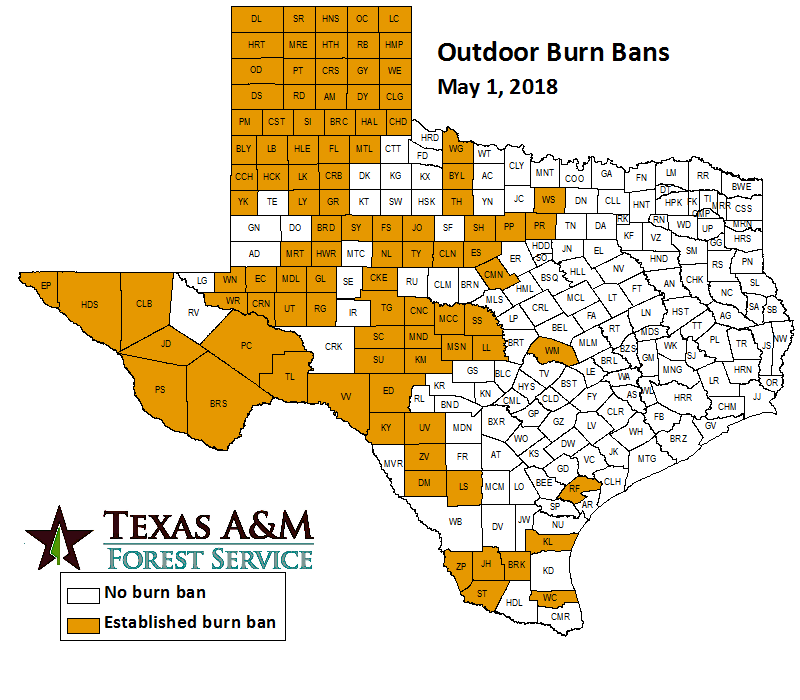
Burn Bans/Fire
Wildfire danger forecast for Texas Panhandle, parts of West Texas--
Officials with the Texas A&M Forest Service have alerted residents within the Panhandle and West regions that an extreme wildfire danger advisory has been issued. The National Weather Service has forecasted for winds to be around 15 to 25 mph increasing to 30 to 35 mph and gusts upwards of 45 to 50 mph. Residents should remember to obey burn bans, avoid activities that cause open flames or sparks, and properly discard cigarettes.
KTXS, Debra Parker, April 4, 2018
Texas, Oklahoma, Kansas facing tornado and wildfire threats--
There are two different but very significant threats that residents in the High Plains are facing in the coming days. The region is now beginning its most active severe weather period of the year while simultaneously experiencing its driest. Exceptional drought, warm temperatures, and high winds are providing the threat of wildfires while ideal environmental conditions are setting up for the possibility of tornadoes.
Lubbock Avalanche-Journal, Ken Miller, April 8, 2018
Smoky smell in North Texas coming from Oklahoma wildfires--
Strong winds and wildfires encompassing about 366,000 acres in Oklahoma have blown smoke into North Texas. There is no immediate danger of the fires spreading into Texas, however, following the recent rains in the Dallas-Fort Worth area. Conditions will remain mild in North Texas with a high near 66 degrees. The dry weather will continue through most of the week with highs in the upper 70s and low 80s.
Dallas Morning News, Loyd Brumfield, April 14, 2018
Drought
Monthly Change in Drought Monitor Classification


Texas livestock producers may be eligible for drought disaster assistance--
Ranchers and livestocks producers that were affected by the 2018 drought disaster may be eligible for assistance through a USDA program. The USDA sponsored 2018 Livestock Forage Disaster Program will be providing compensation for grazing losses with permanent vegetative cover. Livestock that is eligible include alpacas, beef cattle, buffalo, and goats among others.
High Plains/Midwest Ag Journal, Staff Writer, April 2, 2018
Recent rainfall results in big change in our drought status--
A heavy rainfall event at the end of March has relieved areas in drought while also surpassing the restriction threshold of the Edwards Aquifer in south-central Texas. The significant event included rainfall totals in the range of 4-6 inches. Many portions of Bexar County were originally in “Severe” drought status, but as of recently there has been a downgrade to “Abnormally Dry.”
NBC4, Mike Hernandez, April 9, 2018
Critical Texas drought forecast may alter summer crop planting decision--
The High Plains of Texas are currently in Stage 4 (extreme) drought, according to the U.S. Drought Monitor. The National Weather Service Climate Prediction Center is forecasting an improvement of precipitation in the near future. Growers in the High Plains region will be watching moisture forecasts closely to determine the appropriate planting depth and timing as the hot summer season begins.
Southwest Farm Press, Kay Ledbetter, April 20, 2018
After brief relief, forecasts indicate drought will continue--
Forecasters are expecting dry weather to prolong the threat of wildfires this summer in numerous parts of the southwestern United States. The intense drought is due to a lack of significant measurable rain since October. The dry pattern should maintain throughout the summer and prolonged drought conditions.
Associated Press, Kelly Kissell, April 23, 2018
As drought returns, experts say Texas cities aren’t conserving enough water--
Drought remains a large threat and societal issue for numerous regions throughout the state. About 50% of Texas is classified as being in some kind of drought. Led by the Texas Living Waters Project, officials are trying to push residence to reduce water usage as a means of combating a loss of city water.
The Texas Tribune, Paul Cobler, April 29, 2018
Agriculture/Livestock
Strawberry shortage affecting South Texas--
Consumers of strawberry may have noticed an increase in prices the past couple of weeks. Agriculturalist are pointing towards cooler and rainier that average conditions affecting growing in parts of Mexico and California where nearly 90% of US strawberries are produced. Current weather trends are pointing to more ideal growing conditions with an improvement to normal prices later this season.
KRIS, Roland Rodriguez, April 5, 2018
Texas Crop and Weather Report--
Notable drought has a firm grip on West Texas and the Panhandle. Farmers are being forced to consider these conditions in respect to cattle herds as significant rain is not yet expected to fall soon. Most producers are faring well for the time being even with the lack of significant rainfall since October due to adequate conditions in late fall that provided some stockpiles of forage.
AgriLife Today, Adam Russell, April 10, 2018
Significant Weather
Rainfall/Flooding
Newton County roads flood from Sabine River--
Officials in Newton County reported that water levels in the Sabine River rose to 172 feet, leading to the issuance of a flood warning for the area. Voluntary evacuation were put in place for residents in the area as floodgates from Toledo Bend were open for several days. Residents were concerned that opening the floodgates puts them in more danger and will be forming a southeast Texas committee to speak with the Texas legislature.
KFDM, Quentin Hope, April 1, 2018
Heavy rains spare Texas and Louisiana growers--
Areas in east Texas and Louisiana saw rain total near 6 inches as torrential downpours pounded the area. Tornadoes were also observed from these severe conditions. Numerous regional flood warning were also issued in response to flooding rivers. Some planting officials have reported that the heavy rains had a minimal impact.
Fresh Plaza, Dennis M. Rettke, April 2, 2018
Low rain chance to kick off week--
Rain chances are beginning to creep into the forecast this week after a weekend of warm and fair conditions in Austin. In the coming days, high pressure will begin to build over the area allowing highs to creep into the upper 80s near 90 by Friday. High winds are also expected throughout the day with speeds upwards of 15 to 20 mph.
Spectrum News, Staff Writer, April 9, 2018
HUD Awards $5 Billion to Texas for Harvey, Flooding Recovery Efforts--
Nearly $5 billion is being provided to the State of Texas by the U.S. Department of Housing and Urban Development following Hurricane Harvey and other major flooding events in 2015 and 2016. The main purpose of the funds will be recovery and mitigation. Recovery will be focused on rebuilding homes, while mitigation will be focused on elevating homes and buying out properties to protect from future storms.
NBCDFW, Staff Writer, April 10, 2018
Austin area dodges severe storms, drought conditions remain--
The Austin area luckily missed out on the forecasted severe weather on Saturday. Advisories by the National Weather Service Saturday morning warned of possible hail threats and damaging winds from a line of storms in the Hill Country that would creep into southeast Texas, though the severity of the systems diminished by the time the line reached Austin. Light rains provided enjoyable conditions, though did not significantly alleviate drought conditions that encompass the area, according to the U.S. Drought Monitor.
Austin American-Statesman, Staff Writer, April 21, 2018
Warm Weather
Forecast: Sunny, with a high of 73; elevated fire risk in afternoon--
Sunday in Austin will be sunny with a high of 73 and an overnight low of 49. Elevated fire weather conditions are expected in the afternoon across South Central Texas due to dry air and gusty winds. Monday will see high temperatures in the mid 80s with winds gusting up to 20 mph. Fire weather conditions will be elevated to critical for parts of South Central Texas west of I-35. The rest of the week will see temperatures in the mid 80s and low temperatures in the upper 50s to low 60s.
Austin American-Statesman, Johnathan Silver, April 15, 2018
Houston air quality today may be unhealthy for sensitive groups, weather experts say--
Residents in the Houston area are experiencing the year’s first Ozone Action Day. The National Weather Service issued the advisory after declaring Monday would be a hot, sunny, and still day when conditions would be most favorable for ground-level ozone. The air quality index for the day suggests that sensitive groups such as youth and the elderly are susceptible to health risk.
Houston Chronicle, William Axford, April 16, 2018
Cool Weather
Cool temperatures fill the South Texas air!--
Laredo residents will finally get a reprieve from hot and humid conditions in the coming weekend. The cooler and more enjoyable weather will be brought in by a cold front that will make its way into south Texas. Highs will be in the 60s with lows at night in the mid 50s.
KGNS, Staff Writer, April 4, 2018
Killing freeze possible in Lubbock and the South Plains--
Meteorologist are forecasting the high likelihood of a hard freeze overnight in parts of west Texas. Officially, the National Weather Service Office in Lubbock has issued a Freeze Watch for late Friday night into early Saturday morning. Plants and animals that are sensitive to the very cold conditions should be brought in sight to avoid damage or death as the temperatures dip significantly.
KNOE, Dylan Robichaud, April 6, 2018
Temps drop into 30s in North Texas tonight--
Northeast winds will be gusty today, and cooler than normal temperatures will be brought in to the area. Today’s high temperatures will be between 20 degrees to 30 degrees colder than Friday. A Wind Advisory is in effect for Dallas-Fort Worth as wind gusts of 35 mph to 45 mph are possible throughout today. There is an elevated fire danger today as well due to the high winds and low humidities from the cold front. A Freeze Watch is in effect for late tonight through Sunday morning for areas along the Red River and northwestern parts of North Texas. Temperatures will warm up near the start of the work week.
WFAA, Kyle Roberts, April 14, 2018
Cooler temps back in North Texas Wednesday--
A cold front will bring cooler temperatures into the DFW region, bringing down afternoon temperatures from the high 70s to low 80s to the upper 60s. As the front approaches, high winds will begin to pick up and sustain breezes throughout the day. Rain chances will also come into play on Saturday then move off eastward on Sunday.
WFAA, Kyle Roberts, April 18, 2018
Breezy and cool AGAIN on Saturday--
The DFW area experienced cooler conditions on Sunday as a cold front pushed through the area early Saturday night. Sunday weather will be mostly cloudy before a clearing that will lead to a decent amount of sun and highs in the 70s. Monday and Tuesday should warm again ahead of the next weather system that brings the chances of rain back into the forecast.
Dallas News, Staff Writer, April 21, 2018
An Unusually Cool April--
Residents throughout the north Texas area have observed relatively cool temperatures the past month. As of April 24, the average temperature for the month has been around 60 degrees, nearly 5 degrees below the climatological normal. The Climate Prediction Center forecasts an above average May, which could increase beyond the 83.6 degrees average for the month.
NBCDFW5, Samantha Davies, April 24, 2018
Severe Weather
Severe storms blast through S.A. Tuesday night, dropping large hail eastward--
The National Weather Service placed Bexar County under a Severe Thunderstorm Warning Tuesday night that was in effect until 10 p.m. A strong storm system moved eastward toward south-central Texas and intensified as it approached San Antonio area. Several reports from Guadalupe and Wilson Counties stated that there was dangerous lightning and golf ball sized hail in the surrounding area.
KENS, Staff Reporter, April 1, 2018
Deadly Tornado Tore Through Dallas County 61 Years Ago--
Some North Texas residence are having a day of solemn remembrance as the day marks the 61st anniversary of the destructive tornado that tore through Dallas county. For 45 minutes, the EF-3 tornado had a path of 17 miles with estimated wind speeds of 175 mph. The tornado caused an equivalent of $35 million (today’s currency), killed 10 people and injured 200.
NBCDFW5, Brian James, April 2, 2018
Texas A&M Meteorology students use weather balloons to help detect severe weather--
Meteorology students at Texas A&M University provided support to the National Weather Service by launching a weather balloon. The launch was conducted in front of the Administration building and will be used to determine what is happening in the atmosphere over Brazos Valley. According to a undergraduate student discussed with KBTX that the balloon has a box attached that measures pressure, temperature, humidity, and wind speeds.
KBTX, Amber Treybig, April 3, 2018
Hazardous weather outlook issued for Central Texas--
Residents in the central Texas area watched the skies as hazardous conditions made their way into the region. The National Weather Service issued a severe thunderstorm warning for Bell, Coryell, and Lampasas Counties on Tuesday until 11:15 am. The biggest threats from the system were wind gusts up to 60 mph and quarter size hail.
Temple Daily Telegram, Staff Reporter, April 3, 2018
Strong winds tear apart hangar, cause collapse near Hobby Airport in SE Houston--
Strong winds from a severe storm that passed through the Houston area severely damaged a hanger at Hobby Airport on Tuesday. No injury were reported from the empty hanger as wind gusts in excess of 80 miles per hour were observed, according to the National Weather Service. The large area of scattered debris has kept the neighboring taxiway closed.
KTRK, Courtney Fischer, April 4, 2018
Large hail falls across North Texas--
The National Weather Service issued a severe thunderstorm warning for parts of North Texas during a very strong storm event that brought hail and heavy rains. These storms came ahead of a cold front that cleared out the showers and storms and notable decreased temperatures. After the passage of the cold front, areas just north of DFW were placed under a freeze warning due to the strength of cool air behind the front.
WFAA, Staff Writer, April 5, 2018
Golf ball-sized hail and ‘a few tornadoes’ possible with Friday’s storms--
The coming Friday morning is predicted to be a stormy one for DFW residents. Ahead of strong cold front that will pass Friday, a severe thunderstorm line is expected to form and produce troublesome conditions. Some of the main threats will be heavy rains, fast winds, large hail, and the chance of tornadoes. DFW is currently designated as in slight and enhanced risks of severe weather.
Fort Worth Star-Telegram, Bill Hanna, April 6, 2018
Opening day for Miracle League field postponed due to weather--
Inclement weather postponed opening for the Gene Allen Field in East Texas. The day planned to mark the inaugural season of a youth league allowing baseball players with disabilities to participate in sport activities. Officials with Miracle League pushed back opening day to April 14th after lows in the 40s and wind chills in the 30s provided conditions that were far too cold for the players.
Longview News-Journal, Staff Writer, April 6, 2018
A whirlwind of weather: Cold front brought storms with hail, lightning and a tornado to Central Texas--
Significant storms were brought into the Central Texas area ahead of a cold front overnight Friday. Lightning strikes, heavy rain, and hail were all observed from the system. The National Weather Service reports that a tornado touched down in Burnet County.
Austin American-Statesman, Mary Huber and Katie Hall, April 7, 2018
Strong line of storms pass through Houston, sunny day ahead--
A strong thunderstorm made its way through southeast Texas and off to the coast. The system was just ahead of a cold front that produced winds over 20 mph with gusts over 30. After the front passes, Houston residents can expect temperatures in the low 60s with lows in the 40s.
Click2Houston, Britta Merwin, April 11, 2018
NWS: 2-inch hail, ‘critical fire weather’ possible in San Antonio area--
Severe thunderstorms, large hail, and critical fire weather could all appear in the San Antonio area late Friday as a strong storm system, a dry line, and a cold front move through the area. There is a marginal chance of severe weather Friday afternoon into Friday evening along the I-35 corridor. The severe weather has the potential to produce hail as large as two inches in diameter. After the storm system passes, through, low humidities and strong wind could cause fires in the area.
San Antonio Express-News, Caleb Downs, April 12, 2018
First Alert: Large hail, damaging winds and tornadoes possible Friday through Friday night--
A potential storm system followed by a cold front will bring in two rounds of strong to severe storms Friday afternoon through Friday evening. There is a Moderate Risk of severe storms for parts of Northeast Texas. High winds, large hail, heavy rain, and isolated tornadoes are possible with this storm system.
KSLA, James Parish, April 12, 2018
First Alert Weather Day: Strong to severe storms possible, multiple threats anticipated--
Light rain is expected to move into East Texas before noon today, and showers will increase this afternoon. During mid to late afternoon, scattered thunderstorms are anticipated to develop in East Texas. The weather set up is conducive for severe storm development as a very moist and warm air mass is in place over East Texas. As the cooler and drier air blows eastward with the cold front, storm activity will increase as the weather becomes unstable. The threat for severe weather will lessen overnight, but Saturday morning will be chilly. The rest of the weekend will be cool and dry.
KLTV, Jessica Faith, April 13, 2018
Severe storms bring gold-ball size hail to North Texas--
Residents in Dallas-Fort Worth have reported hail up to the size of golf balls as severe weather moves through the area, bringing strong wind and a tornado watch until 9 p.m. as well. Strong but brief storms produced hail up to two inches in diameter earlier in the evening, and sirens in Burleson were activated by the Fort Worth Office of Emergency Management to warn residents of the large hail. Another round of cool temperatures will follow Friday’s storms into North Texas, dropping high temperatures by nearly 20 degrees.
Dallas Morning News, Claire Z Cardona, Claire Ballor, and Tom Steele, April 13, 2018
This week’s outlook: Severe weather event possible Friday--
Lubbock recorded another freeze Sunday morning with temperatures dropping to 31 degrees before sunrise. Sunday night will be warmer, but still a little chilly. Lows will drop into the upper 30s and 40s. Winds will pick up speed Monday afternoon, increasing the fire danger threat. High temperatures will rise into the upper 80s with winds 20 to 25 mph, gusting up to 35 mph. Tuesday will be the most dangerous fire weather day across the region as a strong low pressure system moving through the area brings winds between 30 and 40 mph, gusting up to 50 mph.
KCBD, Cary Allen, April 15, 2018
NWS to survey storm damage in east Texas--
The National Weather Service will send a survey crew to east Texas to assess damage in Diana and ORe City in Upshur County after the severe weather Friday. Residents in the two cities reported seeing a possible tornado touch down Friday. Crews have been working to remove downed trees and debris from roads in the area. No injuries were reported from the storm damages.
ArkLaTex News, John Walton, April 15, 2018
How to stay safe and informed during severe weather season--
Meteorologist at new station KTRE are promising to have the most updated weather information this spring severe weather season. Update platforms include the free KTRE First Alert Weather app, available on most smartphones and tablets that will include an interactive radar, hourly forecasts, and video updates. For those without smartphones, the KTRE weather team is also providing the “KTRE First Alert ThunderCall”, that issues severe thunderstorm, flash flood, and tornado warnings.
KTRE, Brad Hlozek, April 16, 2018
Gusty winds Monday, fire danger continues through Tuesday--
Regions within the Panhandle are currently experiencing elevated fire risk on Monday as winds exceeded 30-40 mph with some gusts over 50 mph. Significant moisture has not been observed in the region since October which has allowed for fire conditions to be particularly severe. A cold front passage on Wednesday is expected to drop temperatures, though winds and dry conditions will maintain which should keep fire danger risk elevated.
KCBD, John Robison, April 16, 2018
Storms likely on Saturday--
Austin-area meteorologists are predicting the chance of rain and thunderstorms on Saturday. Chances are low at morning though increase to over 50 percent by the afternoon. Threats of possible severe weather has led athletic officials at the University of Texas to reschedule a double-header matchup between Texas and Oklahoma on Friday.
Austin Statesman, Robert Villalpando and Katie Hall, April 20, 2018
Large Hail Falls in North Texas--
A storm system passing through North Texas on Saturday brought strong winds and hail to numerous cities in the area. The larger measured hail sizes were on the scale of golf balls and hen eggs in the Glen Rose and Weatherford areas. The storm system later moved off toward Alabama, Mississippi, Florida, and Louisiana.
WeatherNation, Meredith Garofalo, April 21, 2018
Severe storms hit North Texas--
North Central Texas residence observed strong severe storms on Saturday. The storm brought intense wind and hail into the urban and rural DFW area. Driving conditions were made dangerous by the hail and winds, along with a rotating wall cloud that did not produce a tornado.
FOX 25, Carlo Falco, April 22, 2018
Inside the Storm 4.22.18--
Strong storms in Texas produced heavy rains and hail over the weekend. Partnered with these conditions, a lightning strike initiated a grass fire in Muleshoe, Texas. Fire safety officials responded quickly to the fire and were able to efficiently extinguish the flames.
ABC7, Staff Writer, April 22, 2018
Texas State Guard Trains for Natural Disaster--
The Texas State Guard is currently in training this weekend to prepare for large natural disasters like Hurricane Harvey. Some of the main training practices include rescue operations, emergency radio communications, and engineer structural assessments. Along with physical and tactical skills practice, the Guardsmen are also being trained on how to use the Emergency Tracking Network, which can be used to track family members during storms.
Spectrum News, Chelsey Trahan, April 28, 2018
Other Climate Impacts
Economics/Technology
Texas Developers’ Use of Fill for Flood Resilience Scrutinized Post-Harvey--
Experts have begun to question the resilience of using dirt to raise homes above flood plains after Hurricane Harvey. One of the biggest criticisms of the dirt/fill methods is that flooding can be worsened by reducing storage of stormwater. According to the Houston Chronicle, over 200,000 homes in Harris County were outside of the 100-year flood plain, so new methods will need to be developed for home resiliency.
Insurance Journal, Associated Press, April 11, 2018
Importance of Environmental Resiliency Along the Texas Coast Highlighted--
The director of the Center for Texas Beaches and Shores at Texas A&M University spoke at the Foundation Legacy Society Celebration on Friday. The director’s talk focused on the methods to mitigate flood damage and ecological/environmental resiliency. One of the main tools of combat against environmental damage is the construction of the “Ike Dike”, a large-scale barrier system that would protect Galveston, Houston, and the Bolivar Peninsula from strong storm surges.
Dredging Today, Staff Writer, April 18, 2018
Texans In Hurricane Harvey’s Path Question Housing Recovery Effort--
Officials within the Gulf Coast region and at the Texas Capitol have decided to amend ways in which responses to disasters are executed. Texas governor Greg Abbott requested short-term relief from the Texas General Land Office to ensure effective recovery for the southeastern region. Reporters with the Texas Tribune have suggested that delays in provided funding have caused a delay from the beginning.
KERA, Eric Aasen, April 23, 2018
New FEMA program could lead to repeat flooding under an obscure paperwork change--
Many of the most repetitively flooded structures in Harris county are being acquired by the Federal Emergency Management Agency (FEMA). The plan would allow properties to be redeveloped for future floods. Grants will also be provided to residence with extensive property damage in the coming months.
Houston Chronicle, Mark Collette, April 24, 2018
Hurricane flooded cars arriving at used car lots--
Strong hurricanes this past fall in Texas and Florida affected hundreds of thousands of cars by intense flooding. For the most part, many of the vehicles were being scrapped for parts, though some are being sold to buyers at used car lots. Car sales specialists are urging buyers to remain aware and informed of flooded products by using a Carfax or similar history report.
News Channel 5 Network, John Matarese, April 24, 2018
Weather radar picks up widespread bird migration--
Meteorologists at the Fort Worth National Weather Service Office observed an unlikely sight on the radar this past Tuesday. Returns on the radar reflectivity images captured bird flying northward in their migration pattern. The post made by the NWS office amassed over 300 likes and re-tweets, along with use comments like “super refraction” and “intense echoes”.
ABC News, Karma Allen, April 25, 2018
Texas Regulators Pressured To Be Tougher on Pollution Rules--
Members of the Texas legislative branch becoming more tough on enforcing pollution rules after Hurricane Harvey. According to the Texas Commision on Environmental Quality, Hurricane Harvey caused more than 200 toxic spills in the Houston area. A spokesperson for the TCEQ has stated that companies have been penalized for breaking regulation rules during Harvey.
Houston Public Media, Travis Bubenik, April 25, 2018
FEMA to Hurricane Harvey Evacuees: Your Time in Hotels is Up--
Over 1400 evacuees displaced by Hurricane Harvey are being told that they must leave FEMA-funded hotels this week. The agency has determined that enough housing has become available in the five main counties affected by the storm. Some eligible homeowners residing in hotels may be given an extension until May 31.
The Weather Channel, Pam Wright, April 26, 2018
Texas gas prices rise as summer weather approaches--
Gasoline prices continue to increase substantially across Texas this spring season. The average price for unleaded gasoline in the state was $2.58 for the week, a 34-cent increase from this time last year, with even higher prices expected going into the summer. Expert prediction suggests that the national average will reach a peak price at $2.74 per gallon between now to September.
Austin American-Statesman, Sebastian Herrera, April 27, 2018
Harvey recovery funds may prioritize wealthy, advocates say--
Some advocacy groups are stating that the State of Texas may distribute billions of dollars in federal funding to wealthy homeowners for post-Harvey home repair. The advocacy groups suggest that a combination of funding thresholds and poor FEMA inspection calculations could exclude low and middle income areas. Many are hoping that federal programs be augmented to provide better security for non-wealthy communities in the future.
Houston Chronicle, Will Weisset, April 27, 2018
Texas’ power grid operator won’t rule out rolling blackouts as tight supply meets high summer temps--
Power plants within Texas will be generate more electricity than in previous years this summer season. The National Weather Service is predicting a 60% chance that temperatures will be above average in the coming season in Texas. With the amount of energy that will be generated and consumed, usage will increased and possibly lead to rotating outages.
Dallas Morning News, Jeff Moiser, April 30, 2018
Recreation/Leisure/Athletics
A&M baseball calls off Tuesday game vs. Houston due to weather--
The Texas A&M and LSU baseball teams were set to face off in a Thursday to Saturday series, but were delayed due to inclement weather in the area. The decision to delay the games was made Tuesday by officials in the athletic department at A&M. Future dates for a makeup series are currently being planned.
24/7 Sports, Brian Perroni, April 3, 2018
Garden Sense: Weather is right for spring chores--
Regular rainfall and mild temperatures have allowed spring landscapes in Central Texas very visually appealing. Expert gardeners are advising planters to replenish mulch this month before temperatures heat up going into the summer. Watering and fertilization is also very important as conditions can become dry and non-ideal with increasing winds and higher temperatures.
Bryan-College Station Eagle, Charla Anthony, April 6, 2018
Clouds, wind shorten HOT Airshow’s first day--
Many spectators at the Heart of Texas Airshow were disappointed by the presence of poor weather that inhibited complete performance pilots. The Navy’s Blue Angels precision flying team was one of the main draws at the event hosted at Texas State Technical College in Waco. Performances were cancelled for due to low cloud ceilings and strong winds in the area. Officials made it possible for spectators with Saturday tickets to return on Sunday.
Waco Tribune-Herald, Carl Hoover, April 7, 2018
The show goes on, but weather puts damper on Dalton Days--
Attendance at downtown Longview’s “Dalton Days” performance was hampered on Saturday due to unpleasant weather conditions. Post-frontal passage, temperatures were fairly cool along with some brief periods of rainfall. Organizers were frustrated with the weather that forced attendance to not observe the usual 3-4 thousand spectators.
Longview News-Journal, Ken Hedler, April 8, 2018
Despite cold weather, local vendors bring the community together at the Denton Community Market--
North Texas residents braced the cold to support opening day of the 9th season of Denton Community Market. Temperatures were a very chilly 34 degrees on Tuesday. Even in the brisk conditions, over 80 vendors set up tables.
North Texas Daily, Rachel Linch, April 10, 2018
Weather causes athletic rescheduling around Southeast Texas--
Athletic teams around Southeast Texas are starting to reschedule their games in preparation for potentially bad weather this weekend. Bridge City’s home varsity baseball game originally scheduled for Friday will now take place Thursday night instead. Lamar’s tennis team, which has postponed or cancelled five games this season due to inclement weather, postponed its Friday match until April 19th in Beaumont.
Beaumont Enterprise, Matt faye, April 12, 2018
Austin weather: Events canceled, rescheduled for April 21--
Forecasters at the National Weather Service predicted a 60 percent chance of rain during the weekend in south-central Texas. The best chances for severe weather will be on Saturday. Some of the events cancelled by official in the area include, the March for Science, the UT-Oklahoma softball game, and the Big 12 Women’s Golf Championship.
Austin Statesman, Staff Writer, April 19, 2018
Transportation & Travel
Windy days ground East Texas planes--
The return of spring in East Texas is usually accompanied by a return of breezy conditions. High winds are very problematic for pilots by posing risks to safety of during flight. According to the Rusk County Airport Manager, small aircraft traffic is nearly nonexistent on gusty spring days.
KLTV, Jamey Boyum, April 19, 2018
